Blog #7: Streams, Fields and Sweet Gums

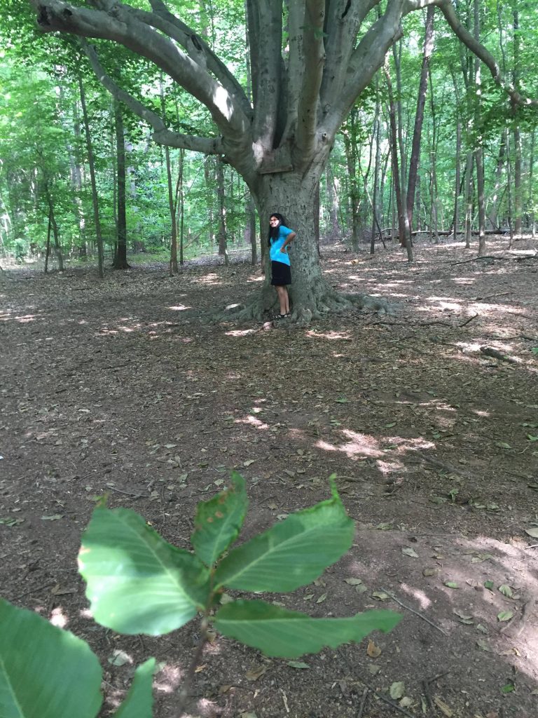
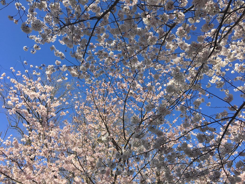
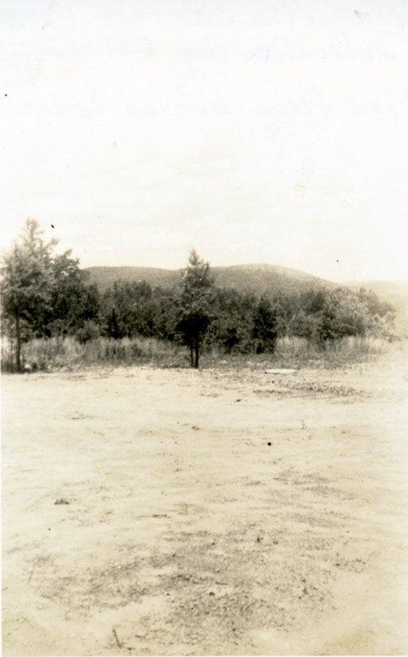
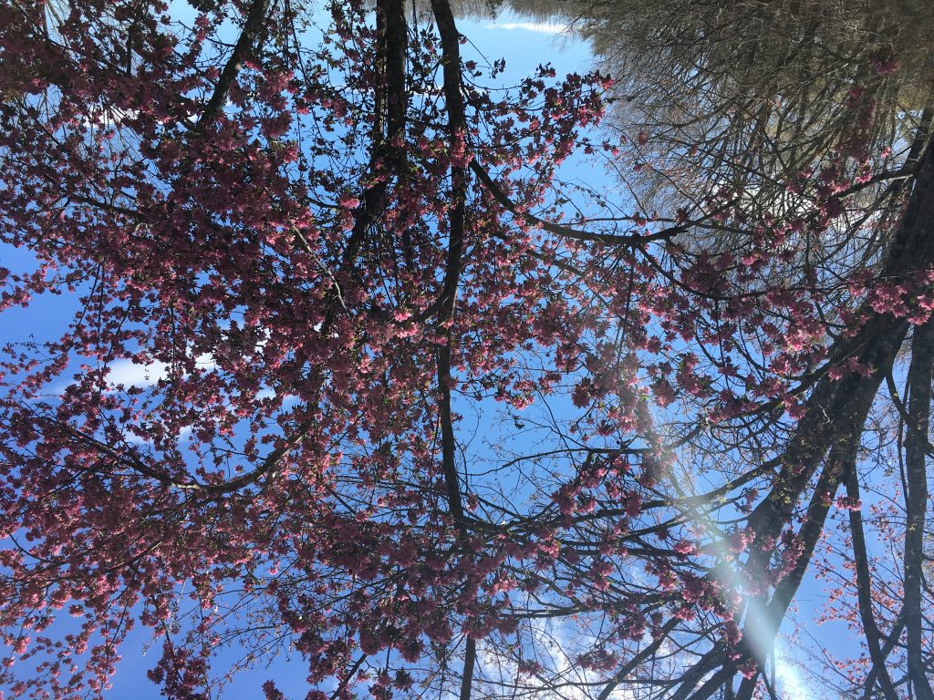
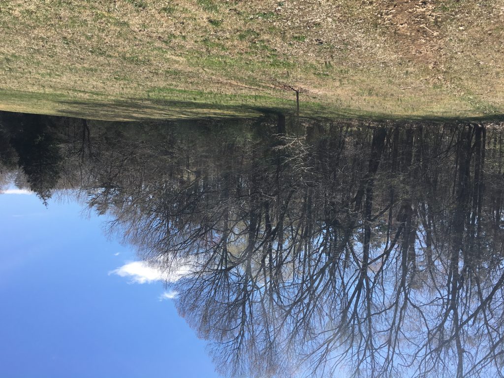
Despite coming down with some kind of cold, I wanted to do at least one productive thing by the end of the day. And so, I went to the park just to get a little time in the sunlight and unwind after a rather stressful and busy week. So after parking my car under the cherry blossoms once more, which still looked absolutely beautiful by the way, I walked down that long, grassy field to the left of the library. I wanted to get some pictures and just relax while taking a little time to examine an area I hadn’t paid much prior attention to.

No clue why it’s upside down but I’ve tried everything

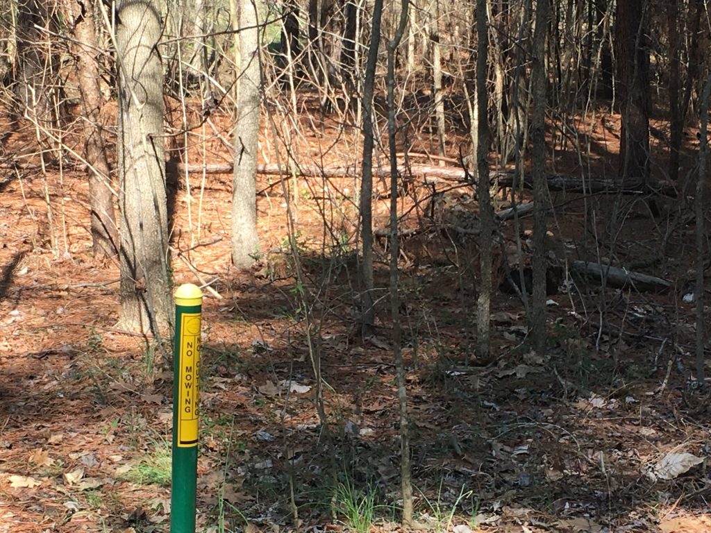
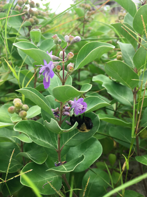
As I just sat in the field and snapped a few pics, I was captivated by one particular tree that had just begun to bloom, containing a purple flower of some kind as a gentle breeze pushed the branches. I tried doing a little research on this flower in the management plan but nothing concrete came up. Despite that, it was absolutely beautiful close up and as for the field itself, apparently it takes quite a bit of effort to keep the grass mowed. The plan mentions that while typical mowing is always an option, controlled burns are an effective albeit rather strange technique to try as well. It appears this technique has yet to be utilized recently as no evidence suggested it, but overall it’s a funny thing to think about in hindsight. After spending a decent amount of time near this tree, I decided I wanted to see the streams again and listen to the calming, heavenly sound it makes as it endlessly flows.

Field…upside down

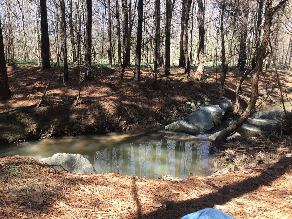
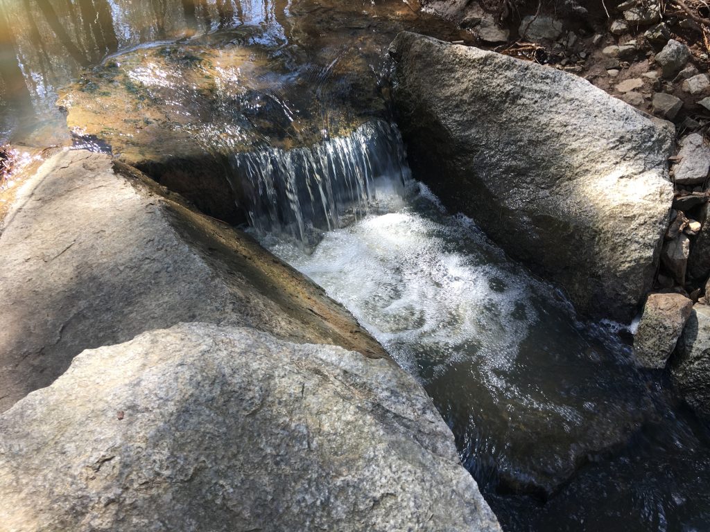
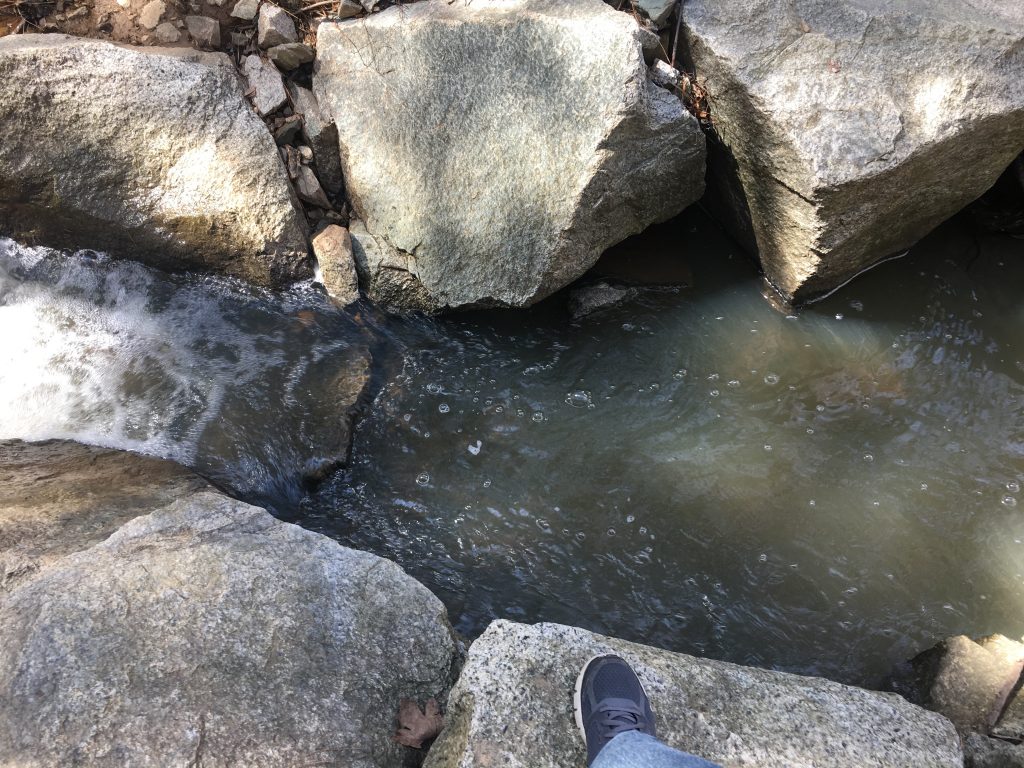
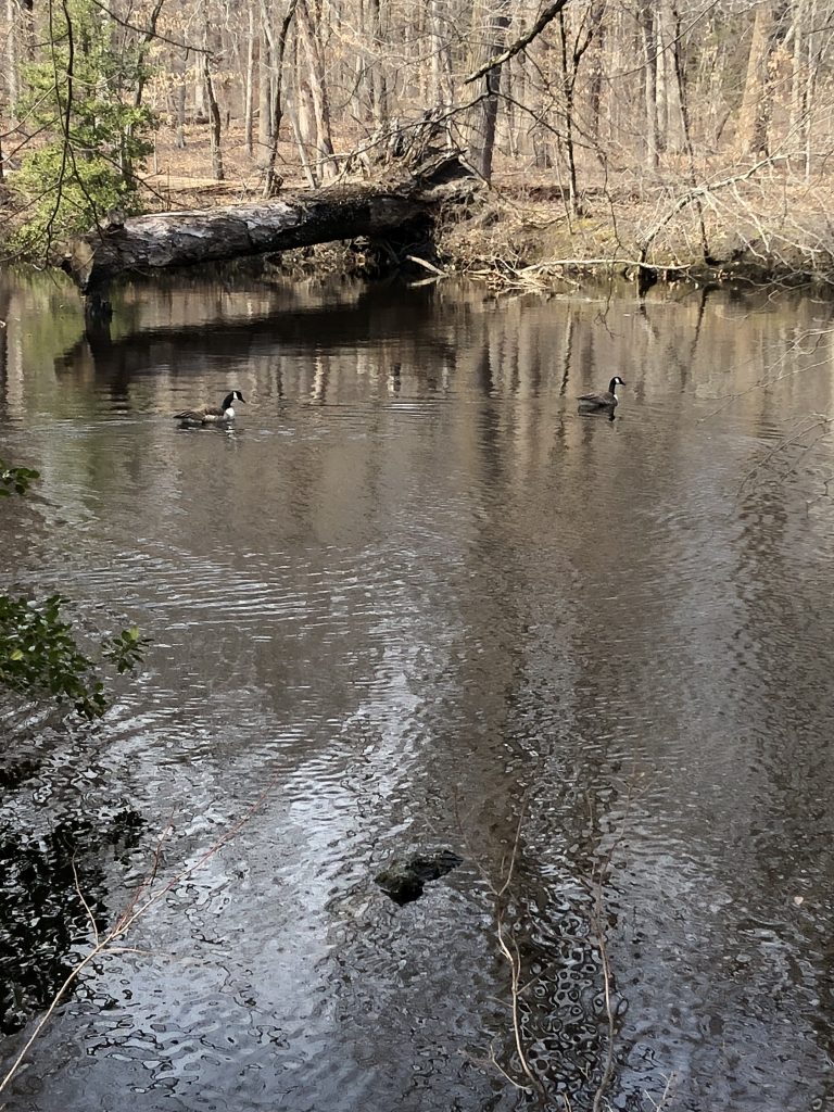
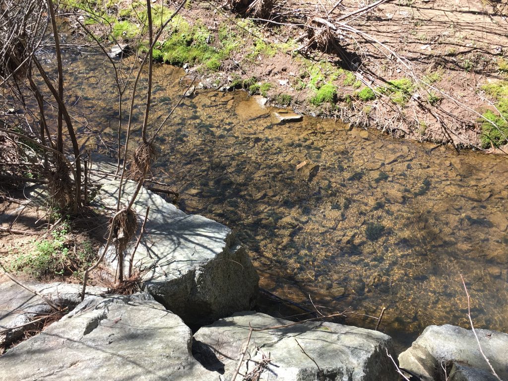
Upon entering the area of the streams, I was quite surprised to see that it looked a lot cleaner and clearer than in previous encounters. While certain areas still looked a tad bit murky, the majority of it was a clear, beautiful and almost crystalline looking stream that shined bright in the warm sunlight of Spring. While I was certainly happy to see the stream in better shape, I was curious as to why it looked cleaner. Despite the obvious assumption that perhaps it had been cleaned, I consulted the park’s management plan for a more official confirmation. While I couldn’t gather much on that, I did learn that the park’s streams take in quite a bit of runoff after major rainfalls and storms. In response, manmade streams have been formed in order to handle this but that doesn’t mean the pure streams are free of all runoff. So it led to my assumption that perhaps the combination of vegetation deficiencies and the previous rainfall led to that murkier look last time. Regardless, sitting on that smooth rock and just watching the stream run its course once again was utterly breathtaking and after a few decent minutes communing with nature, I decided to head home and nurse this cold.

Clear Stream

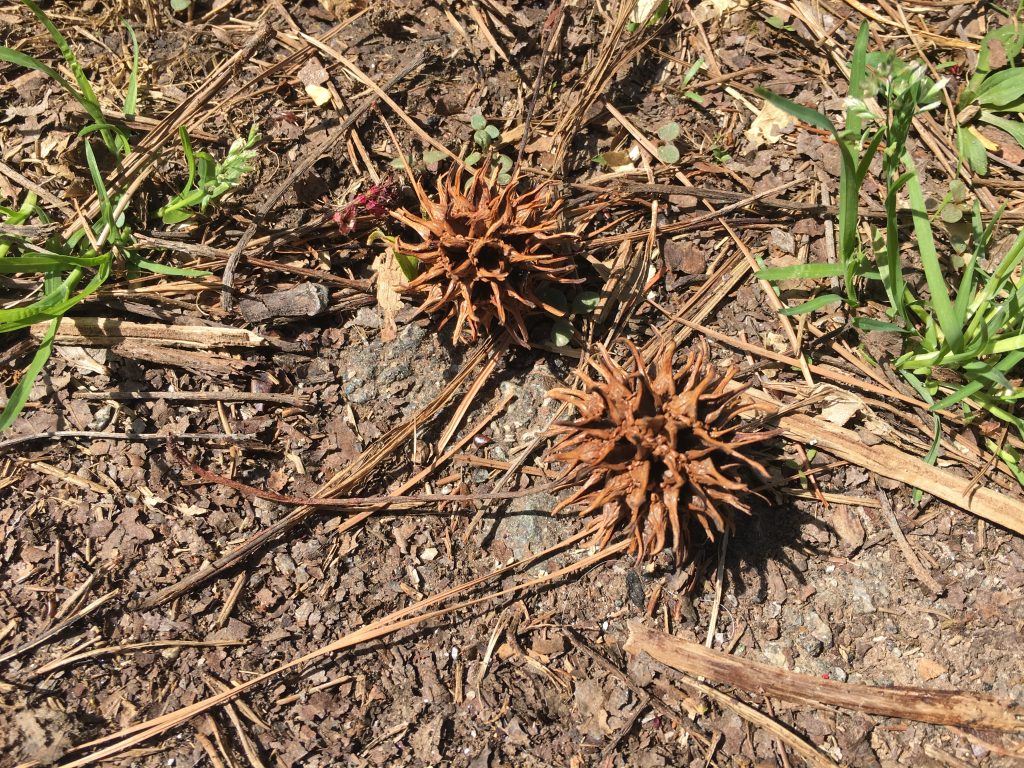
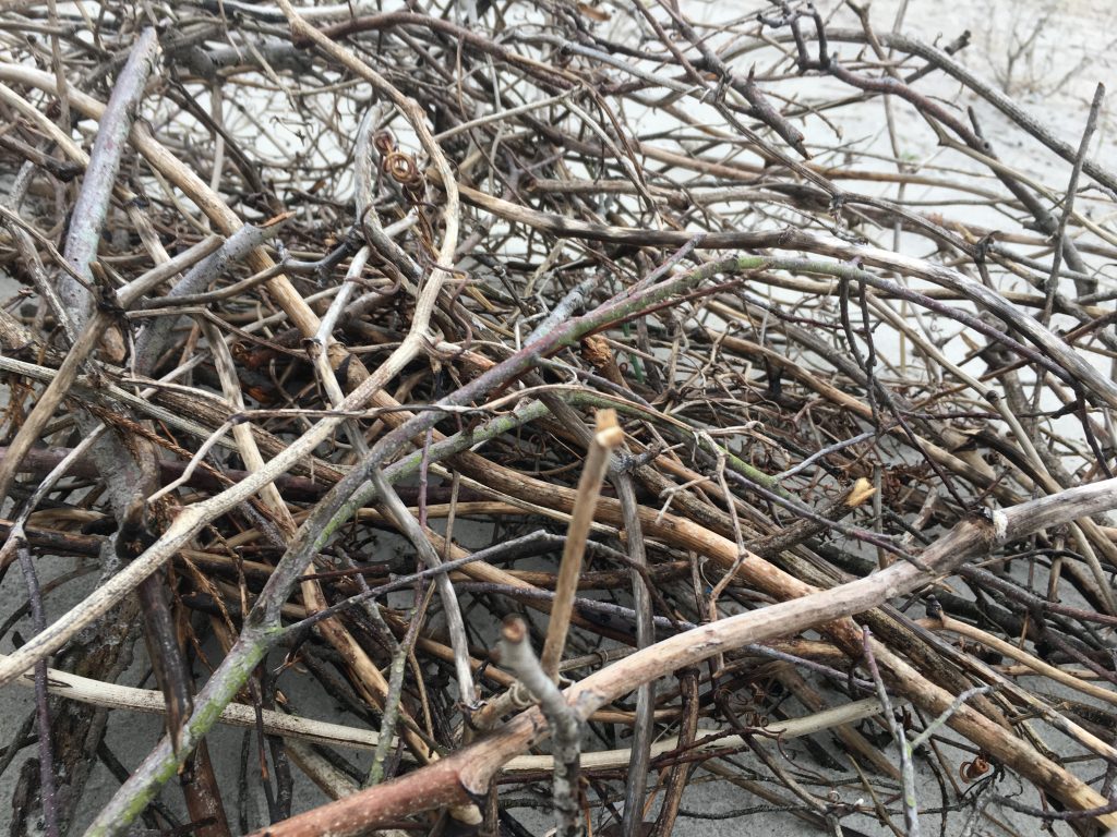
However, there was something small and prickly I noticed while walking back: the Sweet Gum balls. While I never gave them much thought before, today they fascinated me for some reason and I wanted to see if the management plan had any intel on the little prickers. I learned that these things are a bit of a nuisance for the park and occasionally herbicides become involved when they get out of hand. Really made me realize that not everything in nature can have a deeper meaning to it and in the case of these little things, like we always assumed, they’re just a sweet nuisance and that’s all for now folks

Sweet Gums

Pine Needle Tea

The pine forest in the Guilford woods is not obvious. To get there, you can take a few trails. Go at the entrance with the gate, or try the Underground Railroad entrance. You might not find it right away. You may need a hand from a friend. Cross the water, but careful not to slip on the rocks.

If you do slip, your feet may sink entirely into the mud. Find a friend with a hose. It’ll work better than cleaning them in your bathtub.

I first visited the pine forest during the summer. Immediately upon being surrounded by the trees, the air feels cooler. The friend who showed it to me, Theo, said it was because of the wind trapped in the trees. I don’t know how their branches hold the wind, release it gently, but it makes it the perfect place for hanging out in the heat of a NC summer.

The pine trees I see have fragile bark; they seem soft, and when we hang up hammocks, much of it peels off. I feel bad, wondering how much damage I’m doing to the trees, seeing bits of bark fall to the ground. It reminds me of working at summer camp, where we had a weekly ceremony: kids would find pieces of bark on the ground — we emphasized that they could not peel the park off the trees — and we’d put a birthday candle on them. We call these baby boats. Together, we all sat on the dock on the river. We light one candle, passed from person to person, then everyone places their baby boats in the water, and we sing songs about loneliness and trees and camp friendships that will never die, though we know deep down we’re never going to keep that penpal relationship with Katie for very long. This ritual is important to the camp; it’s a tradition that feels like a beautiful closing of a week. But at what cost environmentally? Are we all destroying the earth, bit by bit, in the name of sentimentality? What am I doing now as I put up my hammock and bark peels off?

Sometimes what we think is the most harmful to trees is not, in actuality, always the most harmful. A website told me that drilling hooks into trees can be better for the tree when hanging hammocks. I don’t want to drill into a tree; it feels more permanent, more invasive. I don’t know what this means about me.

My friend Josie lays on an eno in the pine woods.

At camp, the pine trees were a way of knowing we were in a temporary home, because you could smell the pine at all times. If you make pine needle tea, it will give you vitamin C. I told this to all of the campers I lead. I never have tried it myself. I want to, and I think about it, and yet I resist. I resist the taking of the needles out of the woods, into a house with a tea kettle. I resist the urge to build a fire, right there, boil some water, and drink some pine needle tea. I don’t want to ruin what I’ve imagined it tastes like. I like to imagine it tastes like the feelings I had at camp. Like it’s the same as the feelings I have, now, in the woods, looking around. The smell of pine, the coolness of the air. I don’t know why I still resist.

Enjoying the Forest at the feet of Mama Tree

July 2016, the summer before I started my journey at Guilford College, feels like a millennium away and yet, the place where we are is capable of grounding us in memories that seem distant, as if they only happened yesterday. It is a wondrous feeling to visit a space that you are yet to inhabit, I felt a strange dichotomy between imagining myself as a living, breathing piece of all these different locales that make a campus come alive, and also felt strangely out of sync in a space that has seen centuries of experience in historical, academic, and spiritual life, of which I was now a part.

My parents and I, as we tried to conceive of my life at Guilford, traversed from one end of the campus to the other, and finally, we drove down to the tree lovingly referred to as, “Mama Tree.”This was our first experience of the Guilford College Woods, also known as the New Garden Woods, located in Greensboro, North Carolina, in the United States of America. This tulip poplar behemoth had been a beacon of light for many African American slaves traveling the Underground Railroad, a network of safe houses intended to guide them to freedom. This particular spot was established on the railroad by Levi Coffin, a native of Guilford County, North Carolina, and other fellow Quakers, who were staunch abolitionists, stemming from their religious beliefs that every person had the light of God in them. James Shields, the Director of Community Learning at Guilford College, described how one group of slaves had White slave catchers hot on their trail, but when they hid behind the tree, they could no longer be seen. Levi Coffin would even venture into the woods, with the purported excuse of feeding pigs, and provide fleeing slaves with food and supplies.

But the Tulip Poplar wasn’t the only tree to bear witness to this fight for freedom. 150 years ago, the forest was covered with thickets of pine trees, now replaced by elm and oak trees. The trees aren’t alone in this forest either, as white-tailed deer, groundhogs, and squirrels frequent this trail more than tour groups do. As we snapped pictures and reveled in the wonder of majesty and tranquility, we glimpsed a familiar friend, a bright red cardinal, specifically, a northern cardinal (for the avid avian adorers out there, simply saying that we saw a cardinal might be confusing, as there are many different types). This type of cardinal is what North Carolinians, like myself know as our state bird. It landed on a branch far above us, and I whistled at it. Surprisingly, it whistled back, and we went back and forth until my parents wanted to go. Much to my amazement, I managed to commune with an unofficial member of the Guilford College campus a month before my arrival on campus. I like to think of that bird as my first friend, but more importantly, looking back has given me the opportunity to understand what exactly I saw around me and immerse myself in it once more.

Blog #6: Flora

After working almost all day I needed to relax. With the cherry blossoms in bloom and the weather clearing up nicely by the time I was ready, I headed down to Price Park for a little down time. I know I’ve only briefly touched upon the park’s resident flora before, so this time around I knew I wanted to dive a little more in depth on just what inhabits the park. Needless to say, the expedition was a success as I saw not only the cherry blossoms in full swing but numerous other wonders within the park trails.

Cherry Blossoms in full swing

As I walked down the trail, with sweet gum balls scattered all around me, I noticed a peculiar piece of litter off the beaten path. It was a half broken glass bottle that looked like it still had some mysterious substance inside. Upon a closer look I was rather surprised to find not just dirt but some type of algae growing inside the bottle. Almost like some kind of vegetative ship in the bottle. It left me wondering whether or not this was purposeful on someone’s part and if not, exactly how long has that bottle been there to reach such a state. Needless to say, it looked awesome though, to the point where I found myself examining it for a solid two minutes before finally deciding to take it back and properly recycle the bottle later on.

Vegetative Ship in a bottle

As I continued on the trail, I came across a familiar sight with a vast array of flora near some trees, complete with a sign identifying the types of plants by assigning them all illustrated appearances and different colored shapes that they would make signs for and hang on the trees. The two that were most prominent at the site were the orange, hexagon-coded American Hornbeam flower and the yellow, circle-coded Flowering Dogwood, both of which were fairly present and eye-catching in an otherwise bland selection of the scenery’s vegetation.

American Hornbeam, dunno why it’s upside down

While I couldn’t get any great pictures of the Flowering Dogwood, there were plenty of Hornbeam flowers all congregated around a particular area, that made for the perfect shot and with the park’s management plan now at my disposal, I wondered if there was anything to note about the plant. Strangely enough, there was nothing really to note and I realized a quick google search was in order. By far the most fascinating thing I learned is the fact that they are actually a slow growing tree. Really makes you realize that there’s more to flora than what meets the eye. 

One of the park’s many beautiful trails

And so, with some new flora knowledge and a stress free activity over and done with, I was ready to call it a day and whip this post up for you guys. I wanted to bring a little more awareness to the park’s trails if anyone’s ever looking for a nice, quiet place to take a walk. The scenery’s downright beautiful with some nice fact signs and flora along the way, perfect for nature lovers of all kinds. Next time I’ll try to find some more flora and fauna to emphasize and discuss, but that’s all for now folks.

Price Park

Blog #5: Streams

Inspired by our wonderful trek through the Guilford Woods this morning, I decided to head down to Price Park on this beautiful, sunny day after getting my after-class coffee. I knew I had to get some research about the park in this time around and after Jim showed those modules in class I knew I was all set for this next post. But I just wasn’t sure of what this one was gonna be about. That is until I got to the park and took a walk along the paved path.

Mother Nature: “I AM the Law!”

As I started walking, jazz in the headphones and warm sun shining down on the gravel, I saw a familiar sight, but one I never looked close enough at to recognize it’s brilliance. There was a small little metal post in front of all the trees near the stream and it read “No cutting” as a tree behind it laid promptly on the ground, possibly due to winds. I just burst out laughing at the realization that society can make as many rules as they want, but Mother Nature obeys none. From there, I was captivated by the sunshine as it lead me past the sign to the trail’s stream, an area I had seen plenty of but never really stopped to admire. And on a day as beautiful and warm as this, with the sun shining down on the muddy but mesmerizing seascape, I realized I knew exactly what to write about this time around.

To even try and describe the beauty of this stream would not only be an injustice but a complete waste of time when these photos capture it all. What I will talk about was how peaceful the time I spent near the stream was. As I headed down to the main hub, I sat down on a surprisingly comfy and clean rock, I just sat there and gazed at the stream for the better part of 20 minutes as my playlist continued. Combining the scenery with the music and the warm feeling of the sun just made the place feel like something unreal, a place unburdened by society. Well, except for me, of course. Eventually though, I felt like there was more I could see so I walked a little further down and found a group of rocks with an amazing new angle of the stream, so naturally I stood on the rocks and collected some killer shots before finally feeling satisfied enough to head back to campus.

I was on the rocks when I took these last two photos, very stable, no danger of any kind.

After getting access to the Price Park management plan, I flipped to the section about the streams I’d encountered and from what I’ve gathered, many of the park’s waterfront, including the streams have been restorations. The plan stated that the park’s streams have not met their expectations and do contain some issues that were visible when I reflected on the visit. The most prominent of these was the fact that reports from 2002-2005 and 2008 said that vegetative density deficiencies (which would explain the murky looking water) as well as channel instability problems were the main issues at the moment.

Regardless, the stream was a true beauty and it was quite a peaceful day thanks to that little visit. Now that I have access to the management plan I’ll definitely try and examine some aspects of the park I’ve already discussed with some added context but also continue to explore and expand on the areas I discover. But that’s all for now folks.

Price Park

A Vicious Invader

Smooth, round disks of leaf nestle in bunches by the shore. Their slight silver tinge abounds across miles of beach, the vines hugging tightly to the sand below. Bumblebees are drawn to their buds, tickle the soft purple petals, emerge with puffy legs dusted in pollen. When split open a smell like licorice and mint leaves caresses the air. By all accounts, Beach Vitex ought to be welcome on North Topsail Beach. But this is merely a tourist’s fantasy; a facade of Summer that is only skin deep.

Image: Beach Vitex and Bumblebee in Summer

Of course, tourists have not been the only ones fooled by the appeasing look of Beach Vitex as it rustles unassumingly in the warm, salty breeze. Introduced to the East Coast in the mid to late eighties, the deciduous vine was brought from Asia to be utilized for both aesthetic and environmental purposes. With its rolling branches, pastel colors, delicate flowers, and sweet smelling bark, it was quick to win the hearts of many. So quickly, in fact, that apparently no research was done into the actual nature of the plant.

Thought to be the perfect candidate for limiting erosion, Beach Vitex was considered an alternative to native species, whose root systems have long kept sand from being drawn out to sea or blown halfway across the world. Unfortunately, no mind was paid to the fact that Beach Vitex enters more than a dormant state following the Summer months. During this period, it essentially dies—not only losing its buds and leaves, but its roots as well. Every Winter, they retract, poking out through shallow sand, leaving the deeper levels barren and the area overall vulnerable to erosion.

Image: Beach Vitex in Winter

Were additional root systems to exist in areas where Beach Vitex prevails, this would not be such a devastating issue; however, the species has been found over the years to cause “intense substrate hydrophobicity that persists for several years” following its removal. Essentially this means that the sand surrounding Beach Vitex becomes repellant towards water, thus depleting the area of resources needed to sustain additional plant life. As a result, American Beach Grass withered, Sea Oats withdrew, and all aside from the occasional cluster of Pond Pines was ultimately choked out—paving the way for erosion galore.

Image: Example of Beach Erosion

As of February 1st, 2009, the Beach Vitex was officially added to the North Carolina Noxious Weed List. Not only can the species no longer be sold or maintained, it is also required by law that all known populations be reported to the official Beach Vitex Task Force. What was once a highly sought after plant, thought to be the answer to all coastal needs, has become a fugitive—breaking the law by merely taking root. Conversely, according to North Carolina state law, it is “unlawful to dig up, pull up, or take from the land of another or from any public domain the whole or any part of any Sea Oats,” without the approval of a special request.

Image: a mixture of Sea Oats and Beach Vitex, competing on the dunes.

Once thought to be the ugly, itchy, straw colored predecessor to the new age Beach Vitex, Sea Oats are now proclaimed saviors of the land. With their extensive root systems, resistance to drought, and generally robust nature, they implore humans to see beyond artificial  conceptions of beauty, and focus instead on deeper levels of understanding.

Sources:

http://www.northinlet.sc.edu/beachvitex/media/Invasion%20alert.pdf

https://brunswick.ces.ncsu.edu/wp-content/uploads/2013/04/Beach-Vitex-Brochure.pdf?fwd=no

https://www.fws.gov/raleigh/pdfs/NativePlantsCoastalNC.pdf

The Kirkwood-Cohansey Aquifer

I don’t want to lose Camp Dark Waters and the Pine Barrens altogether, but it looks that way! Because Camp Dark Waters is on the edge of the New Jersey Pine Barrens. The Pine Barrens soil is a sandy, poor soil that allows sturdy plants like the pitch pines, cedar, and the blackjack oak to grow. Underneath the soil lies a huge acquirer called the Kirkwood-Cohansey Aquifer. It ranges over 3,000 square miles and has 17 trillion gallons of water. Unlike some aquifers, the Kirkwood-Cohansey is not surrounded by rock but is caught between layers of sand and gravel. The sands soak up the rainwater are the cause of the many streams, creeks, rivers and the wetlands in the Pine Barrens.

A Map of the boundaries of Kirkwood Cohansey Aquifer System (Photo Credit: Yale Environment 360)

The Pinelands Ecoregion once ran from Delaware to Cape Cod Massachusetts. As developments grew, the water and lands were compromised. The New Jersey Pinelands National Reserve was created in 1978 to allow development around the edges of the Pine Barrens to protect this last standing part of Atlantic Coastal Pine Barrens lands.

The Garden State Canoeing (1992 Seneca Press) describes part of how the Pine Barrens became protected: “The Mullica River drains the heart of the Pine Barrens, about 100,000 acres of which now lie protected as the Wharton State Forest. Back in the 1870’s Joseph Wharton bought up all those supposedly worthless acres, recognizing the value of the underlying aquifer as a future water supply for Philadelphia. But a parochial NJ legislature passed a law quashing this potentially lucrative plan. While Wharton ultimately managed to find agricultural value in the land, his heirs saw fit to sell the tract to the state.” The region was not so safe in other states. By the 1950s the aquifer, which used to supply Long Island’s drinking water, was full of nitrates, detergents and agricultural products. In 1993, New York finally passed legislation to protect the remaining core 55,000 acres of what had once been a quarter million acres in the massive ecosystem.


Canadian Geese in the Lake Cotoxen at Camp Dark Waters (Photo Credit by Elanna Spring 2019)

Currently, the Pine Barrens are threatened. Climate change has impacted the precipitation patterns; the governor is planning to run the gas lines through the Pine Barrens; the ecological integrity of the groundwater is at risk due to the runoff from agriculture and septic systems. There is also an increased demand for drinking water as the population has increased. The Department of Environment Protection (DEP) says that the state has sufficient drinking water for the future. However, Pinelands Commissions Director, Larry Liggett feels that the DEP has over allocated it and that the end result will be devastation for the Pine Barrens. If the water is used at this rate, it will create a situation where the lower water level in the wetlands will kill off plant, tree, animal and insect life. This use of water and the lower level in the watershed has led to the infiltration of saltwater into freshwater. The Pinelands Commission has sent proposals and new rules to the governor’s office for review, but so far there has been no movement and no new plan for the future. The Pine Barrens is the largest and relatively undeveloped “wilderness” that is located in the Washington-to-Boston megalopolis. I hope we don’t lose the amazing resources and the intricate ecology that is the New Jersey Pine Barrens. It would be devastating for the ecosystem of the East Coast. Until next time, when I will talk about the uniqueness of the Pine Barrens as well as the important use of “Cotoxen Cabin” in the research of the Pine Barrens by the architect who designed the cabin.

Finding History at Price Park (Lots of Dead Ends)

Topographic map of P:rice Park from 2009

The responsibility of providing the history of a place can be a daunting one. Questions like where to begin, what to look for, how to look for it, and ultimately what is even important can often be very difficult ones to answer. In terms of the history of Price Park, I have come to many dead ends in terms of looking for its history, which, given the history I know about the Guilford woods and because of its proximity to Price Park, I am almost sure is a rich one. Regardless of my assumptions, however, every time I attempt to search the park on an online database, or on a map history database, etc., the farthest back I have been able to go is 1967, and not a whole lot about the layout of the park has changed since then. In addition, even the maps I have been able to find online as far back as that date would cost me upwards of $20 to screenshot or save, but I am hoping to be able to provide a hand drawn replica of one and much more history in upcoming blog posts than what is to come in this.

Having done lots of inconclusive research on Price Park, I ended up calling the Kathleen Clay Edwards Public Library Branch, which is in the center of the park. I asked some questions about the park’s history, and my initial assumptions were confirmed. Like Guilford’s campus, and the woods at Guilford, a lot of the known history of Price Park regards its usage as park of the Underground Railroad, as well as it being the territory for the Revolutionary War in the mid 1800s. Aside from Guilford woods related history, all they could tell me was that the library (before its opening in the early 2000s), was a life insurance agency, which originally opened in the 1950s. This life insurance agency, because of its longevity on the park and its responsibility for allowing the library to take its place, insisted that if a library were to open there, the Kathleen Clay Edwards Branch could not make any significant architectural changes that would stray from the original footprint of the life insurance agency. I’m not sure why this is, but the person working at the library who told me this chuckled and said it was very strange. Finally, I was redirected to the information and archives desk at the downtown library branch, which supposedly has a plethora of information about Price Park’s history before it was Price Park. Therefore, I am ultimately hopeful about finding out much more worthwhile human history of the land.

On a separate note, while human history is certainly interesting, I feel as though the natural history of the land is equally as important. I am hoping to be able to find maps of the park that date further back than the late 60’s so I can compare and contrast the two, and ultimately learn how much humans have affected the natural layout of the land. While I know about how the trees there have progressed over time, and that many of them have been there for over a hundred years, I am curious to know how much more forestry may or may not have been there, as well as waterways, etc. I look forward to talking to the people at the downtown library and finding out what I can about this park that I have grown to love in its current state.

Morrow Mountain State Park: A Long Journey II

Because the history of Morrow Mountain is so deep and rich, I thought it to be deserving of two posts instead of one, and I think by now you may agree with me, reader. So, I’ll pick up where I left off! My main source for this piece of my investigation will the NCPedia history of Morrow Mountain.

After the Native Americans migrated out of the area (the Morrow Mountain Area) there is a bit of a gap in the documented history of the area. We know that the Pee Dee River area has been colonized since about 1700, since this was a major thoroughfare for people and fertile land for agriculture. Some documents indicate the presence of a couple Native American tribes such as the Sapona, Saura, and Catawba.

Before 1808, there is evidence that very little was known about the natural area due to inaccuracies in the early maps and little to no details about the elements of nature found in the area. However, by 1808, we can assume that the area became more popular and populated due to the increase in accuracy of the maps of the area. Included were indications of which families lived where, and documented the small town of “Tinsdalesville” that no longer exists – it was wiped out by a tornado and typhoid.

Kron Family Home on Morrow Mountain Hillside.

In 1834, the Kron family built their house on the scenic hillside of Morrow Mountain, and owned 234 acres of the mountain, that were later sold to a number of people via Dr. Kron’s daughters, and eventually came into the possession of James Morrow. Unfortunately, the original house was torn down in the 1950’s, and all that remains of it today are photos and a reconstructed version of the house that was completed in the late 1960’s. In 1884, Morrow Mountain, which was later named for the owner of the land James Morrow, was struck by a catastrophic hurricane, stripping the mountain of its trees and, for a time, earning it the name “Naked Mountain.”

Photo of “Naked Mountain” cir. 1920. Photograph held at Stanly County Museum.
James Morrow photographed at the dedication of Morrow Mountain State Park on June 29, 1940.

In 1930, a committee was formed for the incorporation of Morrow Mountain as a State Park, and one of the sitting members was no other than James Morrow himself. Morrow, among others on this committee, were highly instrumental in securing a $20,000 bond for the purchase of land for the park. This land was then turned over to North Carolina’s Department of Conservation and Development for development and administration.  Because of this, over 1,800 acres of total land, including the land that constitutes the Morrow Mountain area, were donated to the state and development of the park eventually began in 1935. By September, the area of land being developed for state park use had increased to 3,000 acres, which pushed back completion of the park and its facilities to 1939 instead of its predicted 1937.

The park finally opened for public use on August 17, 1939, and the dedication ceremony was held later on June 29th, 1940. The celebratory festivities included a parade through Albemarle, a “bathing beauty contest,” an address by the Governor, and a water carnival (whatever that is). Morrow Mountain State Park was a big deal!

Yes that’s right, Morrow Mountain was recognized as a state park before the Uwharrie Mountains were made into an “official” national forest! As it stands now, the entire park is 4, 508 acres.

Additional Photos:

Morrow Mountain State Park: A Long Journey

One of the most famous sites within the Uwharrie National Forest, one that I have camped at many times, is Morrow Mountain State Park. Being the highest peak in the park, Morrow Mountain is a popular destination for day trips, beginner hikers, and local folks looking to get a bit of fresh air.

As is the case for many mountains and state parks around the nation, this location’s history goes back much further than simply its history as a state park. Since it is one of the most well known, and one of the only thoroughly documented locations in the Uwharrie, it gives us an interesting glimpse into a small piece of the long history of the Uwharrie as a whole. My hope with this short study is to delve into the deeper history of the area and give both you, reader, and myself a clearer picture of the Uwharrie mountains, or at least a piece of them. To do this, my main source is going to be “A Geologic Guide to North Carolina’s State Parks,” edited by P. Albert Carpenter III.

Morrow Mountain State Park lies within the Carolina slate belt, a belt of slightly metamorphosed volcanic and sedimentary rocks that extends from central Georgia to central Virginia.

“A Geologic Guide to North Carolina’s State Parks” P. Albert Carpenter III

Its hard to believe that “600 million years ago” Morrow Mountain State Park was not a state park, but rather a collection of volcanic islands that were in the midst of a “shallow sea,” much like some of the volcanic archipelagos that we are familiar with today. Although the layers upon layers of sediment that once came together to form 20,000 foot tall peaks have eroded away to dirt and sand that has been spread across the east coast and pulled into what we now know as the Atlantic ocean, there are still some remnants of evidence from these ancient times of North Carolina’s oldest mountains. Geologists who have studied the area have discerned that there are “three principal rock types” prevalent in the Morrow Mountain area, and these are rhyolite, basalt, and argillite.

All three of these rocks are evidence of the previous volcanic activity of the area, and can be found in small bite sometimes scattered along pathways or in the green areas of the park.

Rhyolite Arrowheads recovered from the Hardaway Site, held at University of North Carolina Chapel Hill.

10,000 years ago, Native Americans were already making their mark on what is now the Morrow Mountain State Park area, often utilizing the very dense nature of the abundant Rhyolite to make tools and weapons mainly for hunting or fishing. There is evidence that tribes came from all over the area to obtain Rhyolite for tool-making, and these leftover artifacts have left us a rich history of the Native American activity in the area long ago. The Hardaway Site, one of North Carolina’s archeological sites, is very rich in these kinds of Native American artifacts, as are the Uwharries and the surrounding areas themselves, and this is due mostly to the abundance of useful rhyolite in the area.

Article from “Our State” magazine in the “Ramblin’ Man” series about the Hardaway Site and Native American Artifacts found in the Uwharrie area.

In 2014, there was even a Charlotte Observer article written about a man who had inadvertently stumbled upon a cache of arrowheads while planting some bushes in his yard. This was an incredible find, comparable to “winning the lottery,” said one researcher the Observer quoted in their article. Only a handful of similar finds have occurred in North Carolina. Another group of researchers came to the conclusion that they had been buried there around 5-6,ooo years ago as a sort of “ancient armory.”

css.php