Posts

A Brief History

As I mentioned in an earlier post, Lake Norman was created by Duke Energy, a company formerly known as Catawba Power Company, to make a hydroelectric dam to generate electricity. But before the area was flooded, it was a natural space that many people called home. The phrase “natural space” is debatable- it is possible that a location could only be considered a natural space if there is no human development, or even any trace of human impact visible, such as the square inch of silence project. However, I am going to choose to define this phrase as a location in which people can spend time outside and where they are able to observe natural phenomena such as birds and trees.

I am interested in what this space might have looked like before it was flooded. The majority of the land was undeveloped, but there were still a large amount of farms, homes, and community spaces such as churches and schools present in the area. It is difficult for me to imagine what was involved in order to convince these farmers and their families to give up their land and start anew, as it could not have been an easy task. I would imagine that, as with many small scale farmers, many people had inhabited their particular parcel of land for multiple generations, and felt tied to it in a way that was not easily given up. Creating Lake Norman also involved moving public buildings like churches, many of which had cemeteries on their premises. The concept of digging up grave sites was likely not enjoyable for either the power company, the cemetery’s inhabitants, or their loved ones. It’s no wonder it took almost six years for the Catawba Power Company to begin filling the lake. In fact, many cemeteries and buildings remain under the water of the lake to this day. My friends and I used to think that there were air pockets in these abandoned buildings deep under the water, and if you swam too close to them they could pop. Then the swimmer would be sucked into the building with the force of the rushing water, and drown.

What might this view have looked like before the docks and homes? Or even the lake?

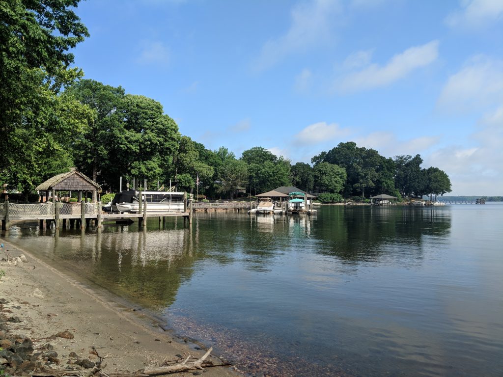
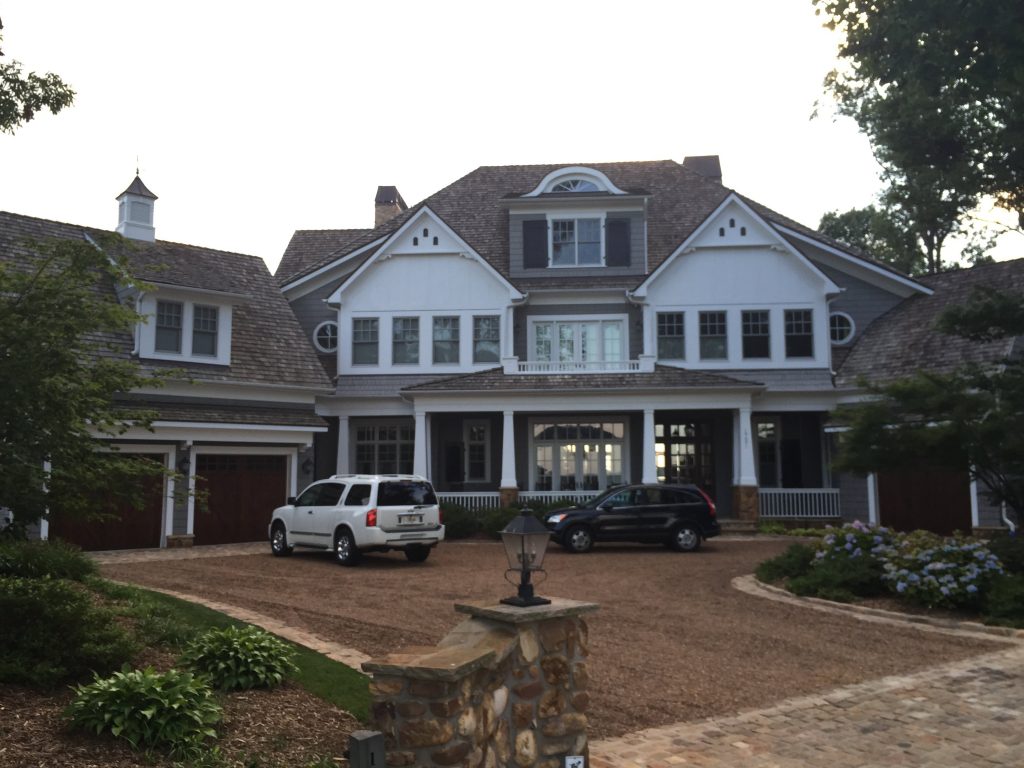
I would still consider Lake Norman a natural space, though it has been developed extensively in the past fifty years. There are many pictures in the lake house of Paige’s childhood, most of which were taken at Lake Norman, and show varying degrees of development of the lot their house is on, as well as the formerly vacant lots surrounding the house. One picture in particular stands out to me- at first glance, the picture is just a sepia photo of a young blonde child proudly holding a fish (presumably Paige). Cute enough, but not very interesting, until my mother told me that the empty lot was the site of the home we were currently standing in. When we visit the lake house now, we can see at least one mc-mansion in any direction, but in the photo there were only trees and water. Assumedly a majority of the trees were the same Silverling and Tulip-poplars that stand around us today, but the difference in the level of development is astonishing. It will be interesting to see how the land changes in the future. Will it even be recognizable as the same place in the photographs in my Aunt’s house?

Just Kidding…. Lake Norman

So…… I changed my location. Further research resulted in very little information regarding any of Lake Brandt’s history, natural or otherwise, aside from a brief paragraph on the greensboro-nc.gov website. The staff working at Lake Brandt also did not have any information to offer me other than asking “Did you check the website?” So I thought it would be best to pick a different location with more readily available information. The place I am now choosing to discuss is Lake Norman, somewhere I have spent a substantial amount of time in my life, and I know some history of already through personal connections.

Lake Norman is, first and foremost, a human-made lake created for the purpose of installing a hydroelectric dam to generate power for areas in North Carolina and other Southern states (making an acception for Ohio). It is the largest and last of seven lakes in the area created for this purpose, and it is owned by a power company called Duke Energy. Duke Energy, at the time called the Catawba Power Company, started making plans for a hydroelectric dam based out of the Catawba River in the early 1900’s.

The idea for the dam came from William States Lee, an engineer from South Carolina who had worked on the hydroelectric plant at Niagara Falls. Lee was then given a $50,000 check by James Buchanan Duke to start the company that would become Duke Energy. The first plans for building the dam were introduced in 1957, and so began the process of buying the land in which the lake would eventually reside.

The lake’s secondary purpose has become providing a vacation spot for wealthy North Carolinians, primarily from Charlotte and its surrounding areas. In just my lifetime, an astounding amount of huge homes have been built on and around the shores of Lake Norman. The house my family has always stayed in, though a very reasonable size, seems tiny in comparison. This house is owned by my “Aunt” Paige and her family (no relation). Close friends with my mother since the age of fourteen, my family’s closeness with Paige is the reason I have spent so much time at Lake Norman. Her father bought the lot the house lies on in 1977, after Duke Energy purchased and flooded the almost 32,000 acres worth of homes, farmland, and natural space that once occupied the area.

A picture of a really big fancy house with cars in a drive way in front
One of the many mansions that have surfaced in recent years

It follows that as more land is “developed” for affluent vacationer mansions and the necessities they require (groceries, coffee shops, liquor stores, restaurants, etc.) animal habitat and truly natural spaces are lost in the process. I often wonder what the area might have looked like, and what plant and animal species it was home to before Duke Energy purchased the area in the mid 1900’s. However, this does not mean that natural spaces are not to be found. When standing outside the lake house, it is nearly impossible to look in any direction without seeing evidence of human impact. From the giant houses sandwiched on the shore to the very lake itself, it is clear that people have had a huge impact on this area. There are contrived natural spaces close to the house such as the small park across the street, but a slightly more authentic outdoor experience is not too hard to find.

#9 Cultural Landscapes

Restoration of Habitat

An old, moss-covered oak tree that stands directly behind the Greene Monument

Since the distribution of the Guilford Battleground lands to the federal government in the mid-20th century, park administrators and park ranger strove to further restore the parkland’s natural spaces and to maintain and protect the monuments erected by the Guilford Battleground Company. As a means of documenting the change of the battlefield, the park publishes a report regarding the authors of the park’s most recent Cultural Landscape report from 2003, break-down the park into three distinctive zones: the Greene Monument, the meadow known as “Schenck’s field,” and the third being the seemingly indistinctive (or at least within the report) surrounding woodlands.

Deliberate Feeling

In addition to the minimal habitat restoration that has taken place over the last five decades, park administrators have introduced other man-made intrusions to the parklands, including additional paved road, park ranger buildings and park offices, lavatories and paved trails along with other signs and historical markers. The most notable maintenance and planned expansions of maintenance within the Cultural Landscape report surrounds the incorporation of additional parcels of land that were donated to the Military park recently by various benefactors. The lands need to be assessed and properly managed.

One term that recurs throughout the section regarding the donated parcels is “landscape integrity,” which refers to the historical integrity of the land. In other words assessing a parcel’s landscape integrity draws into question the human interferences in the landscape since 1781, when the Battle of Guilford Courthouse took place. Additionally, the term is broken up into different subsections: the setting, the feeling, and the association. I find that the most important aspect defined, in this context at least is what the authors of the report define the feeling. According to the report a historical place should convey “ a sense of the aesthetic or historic character that typified its landscape during the selected period of significance.” The authors also note that “ at Guilford, the park’s landscape generally evokes the essence of the heavily forested, battle-era setting.”

Photograph taken near the top of the paved trail leading down into what is known as the “Schenck field”

Construction, Development, Progress

The borders of the historic military parklands are clearly visible from the paved road that roughly travels the perimeter of the park. Modern suburb neighborhoods border the historical parklands, comfy ranch-style houses with backyard playgrounds stand in contrast to the solemn, wooded battlefield behind. A clear border exists between modern residences and historical wilderness though issues regarding where the park ends and the modern world begins didn’t exist around the time of the American Revolution. A specific feeling of the authentic, historical wilderness was the de facto state of the land under European settlement in the 1780s. The need for influential men of the 19th century to commemorate the past, clothing it in impressive bronze statues. Eventually, this formed into the stewards of the 21st century, concerned with the evocation of historical authenticity within the landscape of the battlefield, such a slow but welcomed change in the evolution of land management at the Guilford Battleground parklands.

A place in the present, the Wildlife of the Badlands

While what’s most immediately striking about the Badlands National Park is of course the sheer stature of it’s rock formations, the more green parts of it, are home to a variety of beasts and critters alike.

The one everyone get’s excited about is the Buffalo, though no one there actually calls them that, they are in fact, Bison. But these Bison seem a lucky thing to see on your visit, as they alluded us during the greater majority of our time there. Buffalo, bighorn sheep, coyotes, prairie dogs, mule deer, rattlesnakes, turkey vultures, and grouse, all inhabit these 244,000 acres of Badlands.

In the rockier trails you can find a good deal of signage that suggests weariness of things like rattlesnakes, and across the whole park there is a stern advising to back away from any wildlife you might encounter. The phrasing was always such that you were supposed to fear the animals, rather than demonizing our human impact upon their lives, which was interesting and provided a distinct Jurassic Park feel.

In the daylight we only ever encountered a herd of Bighorn Sheep, situated at the top of a hill on the roadside. We later returned to this hillside for the sunset, and upon leaving the park at night, finally saw a Bison by the exit.

Activity in Place, Exploration

Badlands National Park, like any other national park, is largely composed of various trails to hike on. That was my chosen means of exploration as a tourist in this part of South Dakota.

As one enters the Badlands National Park through exit 131, you drive up a long strip of pavement through very flatlands, until the pavement begins gathering a slight incline. Soon enough you’re approaching the first chunk of rock on the prairie. This rock formation offers the first few trail heads, the Door, Window, Notch, and Castle trails.

The castle trail is truly massive, and thus was not one we dared attempt. The Door and Notch trails however offer a very playground-like sense of exploring the canyon-like terrain of the Badlands.

My friend Jamie, perched at the end of the Notch trail, some hundred feet above the ground.

The Notch trail was a trail that began with rickety wooden rope ladder that laid against a wall of rock. From there you would cling to the edge of the rock, and walk to a greater opening. From there on you’re basically clambering up and down slopes of rock, like multi-leveled bowl of rock. At the end of it, you reach the edge of that bowl, which reveals a startling overlook of the grand expanse of the Badlands.

This sort of wild and grandiose scenery was entirely unfamiliar to me. Climbing a rope ladder was daunting, clinging to the side of a cliff was nerve-racking, and looking down to see ground hundreds of feet below me and a distance that stretched miles upon miles before, was a kind of beautiful threat to my existence I could not ignore.

With this introduction I felt truly OUT of place in fact, and in that vulnerability I began to feel something of a sense for this place.

Badlands National Park, My Introduction

Badlands National Park is situated in South Dakota by the Pine Ridge Reservation.

I came across the Badlands National Park while traveling cross-country this past summer. My friend and I had just left the more metropolitan twin cities of Minnesota, when our drive bled into vast prairie land and rocky canyons. My time in the Badlands was in fact quite short, and by no means a visit with any sort extended exposure. However I believe this notion of sense of place, can be found equally as in the immediate and striking introduction of a new place as one would in growing accustomed to one for an extended time.

Places like the Badlands, offer such immense stature as compared to most of our day-to-day places. Growing up on the east coast in the metropolitan DC area, these sorts of places were entirely foreign to me.

Sky Credits

One final element of the Guilford Woods I’d like to highlight is the sky, with all of its striking colors, darks, and lights. Coming from 2 places where sunsets are almost mandatory to watch (Colorado’s sky was always beautiful, and Alabama’s was only gorgeous because of the excessive pollution), I had high expectations. Needless to say, I was not disappointed. I think it was the variety that struck me. Morning sky could be both foreboding and warming, midday could be bright and still or hazy and relentless, and afternoon to night could be somber yet animated. One of the first skies I remember that literally stopped me in my tracks was a winter sunset that captured the stillness and vibrancy of the time and place. It was one of the first photographs of Guilford on my phone and I’ll never forget that moment.

Winter sunset from freshman year, photographed by me.

I remember trying to explain the sky here to my mom in Alabama and for some reason, it’s just so difficult to put the sky into words. One, because it is always steadily changing (which makes it hard to paint or draw as well), and two, because as humans, we simply lack the vocabulary to accurately describe pure beauty. We’ve talked about the concept of pure evil and pure good, and again, it comes down to our basic understanding of the word “pure”, because humans are not “purely” one thing or the other, and it’s not something we can readily define. This is why I’m a better artist than I am a writer. When I fail to discover words, I make up for it in paint, graphite, and collage/sculpture. Art is my language, so I’ve been trying to render the beauty of the woods for years in the only way I know how. When my mom couldn’t understand my imagery through language, I created a piece that tried to convey what I was getting at.

This is a piece I made my sophomore year in reference to Guilford’s sky. I used a flat, unsanded 2-foot slab of wood found in the woods and added layers of paint, glitter, spray-paint, wax, and marbles to build up a mixture of colors and textures. The way this piece physically feels to the touch is how I internally feel towards Guilford’s expansive sky. Photographed by me.

I’m not just interested in daytime sky either. Nighttime is a far more mysterious and alluring period and I’m confused when I hear people say they don’t go into the woods at night. The only sense of doubt I’ve had was once when I was a freshman and I was part of a group doing some night exploring. We got to a gathering spot and began talking about the day, when I noticed a flash out of the corner of my eye. I jerked my head to the direction it came from and I waited until I saw it again. About the size of a baseball, about 15 yards from where we sat, I witnessed a glowing red orb, fading in and out, expanding and decreasing, bobbing and jerking in different directions but all within the same area, to the north of us. My first thought was a flashlight, but it didn’t corroborate, so I finally spoke up and mentioned it. Before I could even left my arm to point at it, all three members had already noticed it and lowered their heads, urging me not to look at it or pay it any attention. It took them a while to convince me to not acknowledge the red light, but I had so many questions. After many personal stories, myths, and legends, I was left with the impression that there are lights or “will-o’-the-wisps” in the woods that are always there and I’ve seen many (of several different colors) since then. The only rule when you see one, is to NOT follow it. I was told stories of people following the lights and getting lost for hours and days, or simply being led through portals and alternate dimensions. I know it all sounds a bit loopy, but hearing the stories and seeing the evidence has me definitely convinced that paranormal/extraterrestrial things could be at play in this historic forest.

#6 Examining a Photograph

The Bronze Face of Liberty

The Liberty statue directly in front of the statue of General Nathaniel Greene at the Military Park

The above photograph, I took on the 24th of February 2019. It had been raining for the previous three days and the ground was thoroughly soaked and on my last visit the previous Sunday it had been raining too though not nearly as hard. As I cautiously drove around the perimeter of the parklands to the centralized site of the monuments the rain began to let up and I thought it might finally a good opportunity to take photographs had arisen. Lulled into a false sense of security by the short absence of rain, I exited my car and trotted to the granite steps of the Greene monument and just as I raised my camera for the first picture the rains started again.

Cold droplets irritatingly tickled the back of my neck as the shutter of my camera lense began to flash. I moved quickly and deliberately not thinking clearly about the composition of the photograph I took. I have not had any training in photography and while I care a great deal about taking photographs, my lack of education and training often seeps through into the photograph itself; however, by sheer luck or by some strange providence I finally captured a beautiful photograph. I might brag but the composition, while accidental is striking. The eyes of liberty gaze leftward and down almost solemnly, while three vertical streaks of rain race down each of her cheeks. In her right hand, a shield emblemized with the American eagle shows the dense droplets of falling rain while the whiley brown shades of tree trunks dance in the background.

Which Liberties Exactly

The symbol of “lady liberty,” as seen in the statue at the Guilford Courthouse memorial site, remains a common symbol of American unity in the political climate of American in the tail end of the 19th century, appearing in historical sites including confederate monuments, governmental buildings, and other various battlegrounds commemorating other American wars. She might guard different memorials sit with other metallic though feminine faces but she represents the vision of liberty from the late 19th and early 20th centuries. Her designers, sculptors, and casters long dead and the world that upheld certain tenets of American freedoms have changed along with the world.

The visage of the freedoms idolized by Americans over one hundred years ago is largely not what Americans consider such liberty to be today. The monuments and preserved historical sites stand as memorials to their creators and organizers just as much as they stand as memorials, for example, to the Battle of Guilford Courthouse or any other historical place or period in America. Currently, the federal government claims stewardship over the Guilford Battleground and with the responsibility for the preservation of the historic parklands including the numerous monuments within the property. Time changes values, perspectives, though many historic sites under federal and state governments currently face no threats and will likely remain as pillars of the idolized past.

In a World of Fungi

More than 3,000 unique varieties of mushroom have been successfully identified in North Carolina. About 200 are considered commonly edible. At least 14 species are considered to be poisonous. In only one semester, I identified nearly 80 species with only about 10% of which were thought to be poisonous. Poisonous species found in the Guilford College Woods are as follows:

  • Coker’s Amanita
  • Chocolate Brown Slime Mold
  • Yellow Caesar
  • Dry Woods Russula (poisonous when raw/uncooked)
  • Gemmed/Jewelled Amanita
  • Lilac Bonnet
  • Yellow Patches Amanita (probably)
  • Viscid Violet/Spotted Cort
  • Jack-O-Lantern
  • Greenfoot Fibrecap
Jack-O-Lanterns or Omphalotus illudens that aren’t deadly but very poisonous. Can easily be confused for edible Chanterelles and some species have bioluminescence and glow at night. Photo taken by me in October 2018.

Some of the edible species include:

  • Oysters
  • Indigo Milk Cap
  • Common Puffballs and Pear-Shaped Puffballs (before they turn green on the inside)
  • Beefsteak Fungus (that smells and tastes like beef)
  • Wood Blewit
  • Witch’s Butter (when cooked)
  • Dark Honey Fungus
  • Saffron Milk Cap
  • Flat-Topped Fairy Club
  • Chicken-of-the-Woods
Wood Blewit or Clitocybe nuda found in thick woods, one of 4 found that day, photographed by me.
Chicken-of-the-Woods or Laetiporus sulphureus/conifericola found at the back entrance of the woods. Later that week, 2 friends made a stir fry dinner with some chunks from this bunch after properly getting 3rd and 4th opinions on its identification first. It was exceedingly delicious and had the same texture and taste as chicken. This is actually one of the only mushrooms I have eaten from the woods. The other was a Lion’s Mane mushroom that had been given to our cooking class by one of the farm directors that found it in the woods. Photographed by me.
Pear-shaped Puffballs or Lycoperdon pyriforme that were still young enough to be eaten (the inside is still white). I’ve never personally tried them, but have been told by the 3D professor that they’re scrumptious. Photographed by me.

Thought some seem to be easy to identify as either edible or poisonous, I had to make categories for those as well as the inedibles (not poisonous, but physically unable to eat), the nonpoisonous (one’s that won’t kill you but probably aren’t good), the toxic (poisonous as well as harmful to breathe or touch, like Chocolate Brown Slime Mold), and a large number of edibility unknown (there’s really little information for many fungal species). The 8 species that were considered unknown in edibility were:

  • Shining Waxcap
  • Black-footed Marasmius
  • Bleeding Bonnet
  • Onion-Stalk Lepiota
  • Coral Pink Polypore
  • Mycena amicta
  • Yellow Cracked Pholiota
  • Boletus curtisii
Pink Coral Polypore or Phlebia incarnata which grows alongside False Turkey Tails (and if I’m not wrong, forms a symbiotic relationship with the lichen and is velvet-fuzzy to the touch). Still, little is known about this species and how it survives, so its edibility cannot be determined at this time. Photographed by me.

With names like Purple Jellydiscs, Bonfire Scalycaps, Stinky Squids, and Scarlet Elf Cups, it only adds to the wanderlust of this place. Please be careful when searching for mushrooms! I have the scars to warn to be careful and again, never eat any mushroom without having a 3rd or 4th expert opinion!

css.php