If you enter the woods from the lake, there is a stream immediately to the right of the path. This stream is fed from the Guilford College Lake and flows all the way through the woods. If you follow the stream it will take you to Price Park, which is a public park that backs up to the Guilford College Woods. While following the stream you are taken through an interesting transition from the more private setting of our woods to the more public setting of the park, and along the way you are taken through the back of a housing development. These vastly different environments have an interesting effect on the stream, the way it moves, and the quality of the water flowing through it.
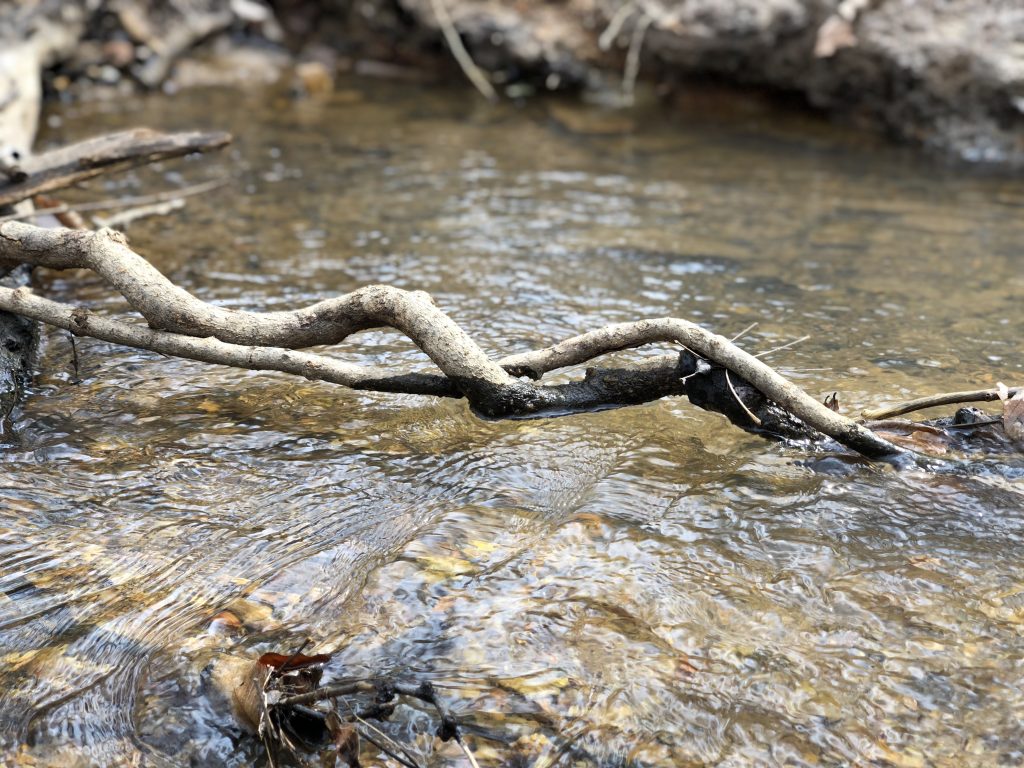
Through the Guilford woods, the stream has many meanders, which means that the stream is slower moving for the most part. However, this also means that the banks of the stream are ever changing. As water moves around the curve of a stream it increases in velocity at the outer edge of the stream and decreases in velocity at the inner edge. This creates what is referred to as point bars and cut banks. The point bar being where much of the sediment is deposited with the slowing velocity, and the cut bank being where the stream cuts in to the stream bank. With meandering streams, the profile of the stream will slowly change over time, due to erosion. This means that over time you can see beautiful natural changes to the way the stream moves with the land, rather than cutting through it. Taking charge over its location and disregarding the paths that may have been set by the people interfering with the landscape.

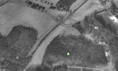
Moving further downstream towards price park the stream naturally straightened out. This was caused by an increase in velocity and volume of water. However, this increase in velocity caused rapid erosion to the stream banks in the park, and also decreased the overall water quality. Because of this, there was a stream restoration project that took place in Price Park, which drastically changed the profile of the stream. As can be seen in the google maps images from February 1993 and October 2015, the stream was altered to create more meanders in an effort to decrease velocity—therefore decreasing erosion and improving water quality. However, this restoration effort was not done correctly and actually ended up having the reverse effect on the quality of the water and the way the banks were eroding.

It is interesting to look at natural landscape that surrounds the stream and how it affects the way that it moves and plays in to the landscape. In the Guilford woods it feels as though the stream is a key part of the landscape and how people interact with it. The stream moves with the land with its meanders, and the water is clear and healthy for the most part. Moving downstream and closer to the housing development, the stream seems to be more of a forgotten relic than part of the natural land. In Price Park the stream is meant to be a pleasant element to a space for people to visit, but the stream does not feel natural in the way it moves. With the man made restoration the stream cuts in to the land, rather than moving with natural curves.