The Bog Garden At Benjamin Park Mess of Species and Plants

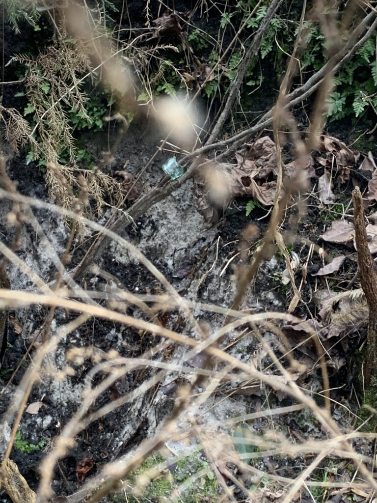
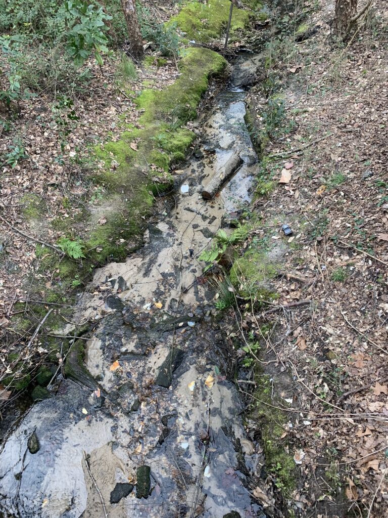
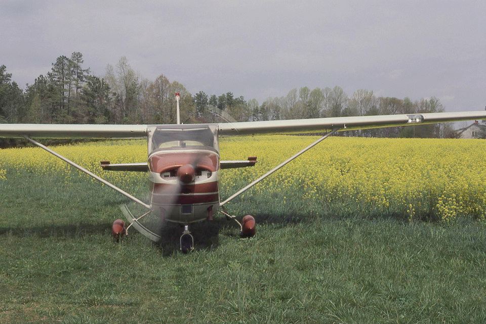
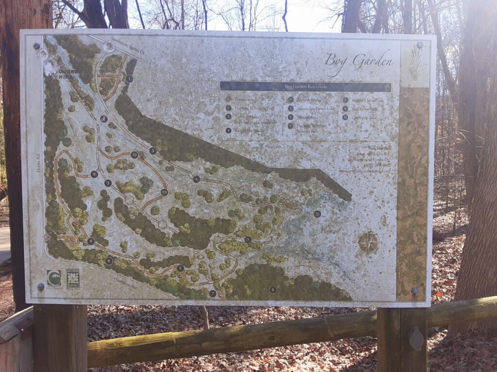
On February 27, partly sunny, still cold outside, but fresh to go out, I wish I had the day where it was sunny and beautiful so I can take more pictures at Bog garden, but couldn’t because of the amount of classwork. But hey it’s always next time, so getting back to the point of wondering and questions about this place is how many plants are there? how many species are there? what’s their infrastructure back in the day when they started building the Bog Garden? what is horticulture and does it relate to this place I pick? and any hybridization or propagation. All these questions I will discuss and answer including my experiences the first time I went to Bog Garden. From the start, I remember the time I went walking on the trail pathways actually specific areas but that’s later on my post that leads to the mini bridges, plants, the lake, and so on it’s really beautiful and peaceful to relax and feel the natural sense. But what really carries out when walking different paths and got attention is the infrastructure like going back my research about the management plan I read it said:” The infrastructure of the Bog Garden is currently such that the plants are the focus of the landscape design,” that makes sense, but here’s a fact back of the day they mention this said: “There are several problem areas on some of the steeper paths that perhaps need the installation of a sub-structure to provide better drainage, surface water shedding, and surface stability,” I didn’t know about that kind of problem.

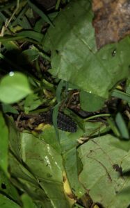
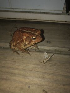
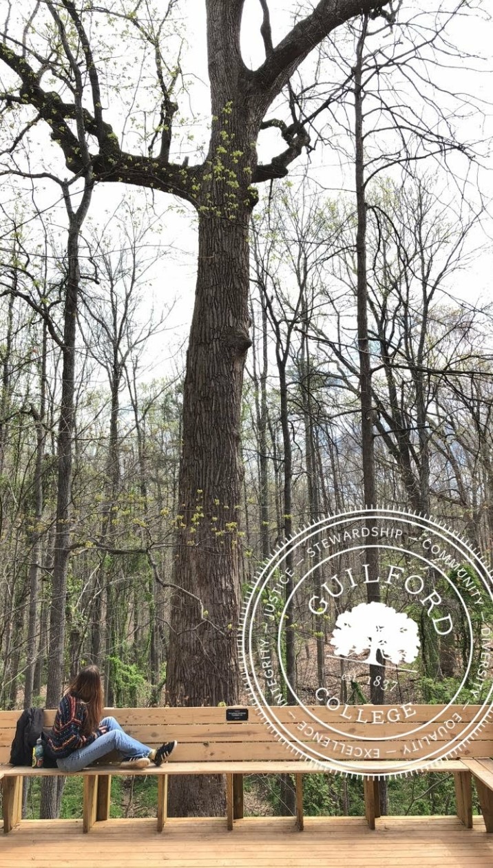
I saw seeing some steep hillsides it’s not that rough and really it softens the structure narrates the natural forest theme of the Bog Garden. Looking back the management plan I read and research about the Bog Garden section on plants, there are a lot in the canopy, subcanopy, shrubs, herbs, and vines, but each of these plants is very different without forgetting there are plants in the garden collection like trilliums, evergreen ginger, ferns, and spring ephemeral wildflowers. When I think in the season in Spring about plants I picture them as beautiful, mature, magnificent, multicolored, delightful, rich and eye-catching because plants are very delicate and it represents something to unique others what they see, can’t wait to see them bloom and luminous smell. Again looking back on my research there are a lot of animals specifically herps, mammals, birds, aquatics, and butterflies, but one animal which I mention from my first post that I didn’t see clearly but only see the back is the eastern cottontail rabbit, it has a body is a lighter color with a white underside on the tail and large hind feet, clearly, I have mistaken my description what I saw, but I really hope to see him again because it’s cute and adorable. All these plants and species are almost like horticulture where is sustainable production and falls between domestic gardening and field landscaping even environmental care.

Feeling A Part/Apart

Walking through Pinehurst Arboretum has always felt special. Every season comes with change and everything feels unique each time. You never know what you will experience. Yet the feeling of the Arboretum, while I took a closer look, has been divided into two, being a part and feeling apart. 

I’ll tell you a story. Pinehurst Arboretum was once a landfill, filled to the brim with plates, glass ware, pottery as well as more assortments of discarded items lost in time and dirt. Yet these items have become a part of the Arboretum. They make up land while stacked between dirt, mud and sand. They are essential to the structure of the creek as much of the items have fallen into the water and in a way become stones. While they hold the integral structure of the creek, compacted with the dirt, they haven’t changed in any way. And while they are a part they also feel apart. All the pottery and glass have been in the Arboretum for decades but they stand out on their own. Apart is what they feel like when they are separated from the earth, from the nature they have been in. When this happens items are not really a part of a whole. But with them crushed into earth they are a part, they feel a part. And that is what matters.

Vine Growing Through Broken Glass Bottle

When I went to Pinehurst Arboretum I felt the same as the plates, pottery and glass. I felt a part of the land and yet I was not, instead I was apart. I was there in Pinehurst Arboretum, I was a part of the whole natural experience but I was only viewing it from the outside in. How can I become one with nature if I am always an outsider? How can I be a part while feeling apart?

Nature is supposed to be immersive. After all humans once came from nature, we used to live with the land, used to be one with nature. But now we have domesticated ourselves. We no longer rely on nature, so we feel apart. 

Childhood Favorite Space, Point Pavilion overlooking Joyce’s Meadow

Pinehurst Arboretum is nature where I am immersing myself in for the upcoming weeks. While I may not feel a part of nature now, I hope to feel a part of nature in the end. To feel close to the earth that gives humans life. To feel like I belong in the space and am not just an outsider or an invader. Immersion in nature is essential to our livelihood, yet humans have moved so far away from natural thinking and feeling. We forget our past connections to nature and what nature has done for us. 

With this feeling of being apart I want to feel as if I am a part of Pinehurst Arboretum as a whole. If I can become a part of Pinehurst Arboretum, then I will have truly connected with the natural space that was given to me, that surrounds me. Helping me to see what nature is fully capable of and the true beauty of nature will be Pinehurst Arboretum.

The Creek, my favorite place in Pinehurst Arboretum

RiverPark at Cooleeme Falls

This place is known to most as the Bullhole but to others it is RiverPark. Where it is, is in a place right in the middle of Mocksville and Salisbury, North Carolina. The Bullhole is a very beautiful place that contains so much fun and activities, for example, it is a great fishing spot and so many people would host picnics and family events (before covid of course)

The reason why this place holds an amount of significance to me is because it used to be where me and my friends would go a lot of the times when we decided to make plans. I used to be a football player and after our Friday night games we would see who would have to work or who was busy and then make trips to hang out there and have a little gathering here and there.

My friends not being the best swimmers it was very nice to have certain parts of the park that had very shallow water for those to put there feet in to get wet or to walk around in. (Although you needed shoes because of the granite bottom and glass that might’ve been thrown in.

The History of Charlotte County and Nisani Farm

2/25/2021

Charlotte County, where Nisani Farm resides, was established 1714 and is full of white human significance.

In 1776 charlotte county voted for independence during the Revolutionary War and French troops stationed at what is now Charlotte Court House (p. 23), only 15 min away from Nisani Farm.

Several important historical figures and places resided in Charlotte County or close to Nisani Farm, including Patrick Henry, one of the founding fathers lived on Red Hill, a property around 10 min from Nisani Farm (Give me liberty or give me death!). Appomattox Courthouse, only 30 min away from the farm was where Robert E Lee surrendered to Ulysses S Grant, ending the civil war in 1865.

Charlotte county was known for antebellum homes and a large slave population to cultivate millions of pounds of mainly tobacco, which Charlotte County produced more than twice as many bushels of corn, wheat and oats. From 1790-1830 the total population in Charlotte County doubled yet the white population stayed the same. The slave population however doubled from 4,816 to 9,433 leaving a 2:1 ratio of slaves to whites (Priddy 29, As cited in the Historic Architectural Survey of Charlotte County Virginia).

After learning all of this information I was curious about exactly what Nisani Farm was used for, or who it was owned by a few hundreds of years ago.

I found two different maps using the Library of Congress, both from 1865. To find who owned the farm during that period I referenced google maps and the designated border of Charlotte County as well as several landmarks. I specifically used the landmark of Cub Creek which appeared on every map making it easy to spot the general area that the farm resides. According to the first map, Maj Pendelborn was the owner of the property although the writing was incredibly hard to read and the google search turned up nothing. 

First map of Charlotte County, Virginia

The second map published in the 1860’s named Gaines’ as the owner of the property. When googling him it turns out Maj William Gaines could be who the first map was talking about. It was difficult finding a reputable source but from what I found Major Gaines was a wealthy plantation owner who owned at least a hundred slaves. I also was able to see that he sent two letters in 1863 about Charlotte County Virginia yet was unable to get access to the letter so that I could read them.

“Letter, 17 July 1863, from R. J. Gaines of Charlotte County to Sallie [Sarah] Gaines regarding her living near the enemy and the losses Confederate armies have suffered.

Letter, 1 September 1863, from R. J. Gaines to William Gaines informing William that there is a place for rent in Charlotte County and providing some family news”

Second map of Charlotte County, Virginia

I was afraid to start delving into the history of the farm, not sure how I would feel when I found out for sure that our property was owned by a slave holder, which is in fact was. Instead of feeling sad, I feel proud of what this land has become. A black, woman-owned farm where we find preservation of nature and sustainability important is a drastically good change from what the property was used for before. I am excited to do more research about the Gaines family and the slaves he owned so as to possibly track descendants.

  • Bennett, Karen M. “Maj William C. Gaines (1767-1850) – Find A Grave…” Find a Grave, 9 Aug. 2013, www.findagrave.com/memorial/115174744/william-c_-gaines#source. 
  • Hotchkiss, Jedediah. “Map of Charlotte County, Virginia.” Library of Congress Geography and Map Division Washington, D.C, 186AD, www.loc.gov/resource/g3883c.cwh00289/. 
  • Cassell, Charles, et al. “Map of Charlotte County, Va.” Library of Congress, Virginia : Chief Engineer’s Office D.N.V., 1864. Cadastral Maps, hdl.loc.gov/loc.gmd/g3883c.la001236. 
  • History.com Editors. “Battle of Appomattox Court House.” History.com, A&E Television Networks, 9 Nov. 2009, www.history.com/topics/american-civil-war/appomattox-court-house. 
  • Blanton, Alison, et al. “HISTORIC ARCHITECTURAL SURVEY OF CHARLOTTE COUNTY, VIRGINIA.” Charlotte County, June 1998, pp. 1–161., www.charlotteva.com/pdfs/historic_survey.pdf. 

Second Outing

This particular outing was yesterday, Feb 24, and it was a surprisingly warm and sunny day. There were many people out enjoying the greenway. Many were walking, jogging, or biking. It was nice to see so many people out enjoying the pleasant weather.

On this occasion, I noticed the bridge at the end of my section. It sits where the Swannanoa River joins the French Broad River, so a lot of water passes under it. It is an old bridge and is rather rickety. It has metal pieces in it that clash when cars go over it, thus it is also a quite loud bridge. It appears weathered and mildly dilapidated. There is a pipe on its side that is broken and missing pieces. I wonder what the pipe was originally for. It seems to now be a pigeon home.

Pigeon in the pipe, possibly assessing life choices.

The bridge was built in the 1950s, but is still considered structurally sound. It is rickety on top as well and feels unsteady to drive over, but the Department of Transportation says it is structurally sound. People have noted that it moves and shakes, but that is normal for most bridges so that they do not crack. On top of the bridge, walkers and bikers have to cross as well as the traffic to continue on the greenway, which is not very easy or safe to do when the traffic is very busy. I have done it, but the walkway is about two feet wide next to the low railing. It needs to be rebuilt or changed in some way to allow for walkers and bikers to cross safely.

I found the bridge notable mostly because it is old and industrial, yet still works. It raises questions of wonder of what all it has been through and had cross over it. I wonder when parts of it broke and where those missing pipe pieces went. I wonder what sorts of things have floated below it and how high the water has flowed because of storms. I noticed that there were small chunks of concrete missing on the edge of one of the pillars holding up the bridge. I guess it is from trees or other things that have floated down during storms.

The bridge. You can see the broken end of the pipe at the top.

The bridge is old and dingy. There are old mattresses tucked under one side where people may sleep. It’s cracked and creaky. It’s industrial and old just like much of the River Arts area. But, it is interesting to see and muse on. And, it still works. It does not seem as though it is about to cave in or need major updates. It is a well traveled bridge, so when it is worked on, there will have to be detour to another bridge further down river. There are many bridges that cross the French broad in this area, each seems to be a bit bigger and higher than the last. It ends with the very high one that allows I-26 to pass into downtown. I remember crossing the bridge countless times and looking down into the River Arts district. It was not a place I went to before I moved to live very near to it. Now, it feels familiar and the bridge very far away, towering over the river and walking paths.

Works Cited:

Boyle, John. Answer Man: Is the Amboy Road Bridge Safe? Acton CIRCLE CONFUSION? 30 Nov. 2018, www.citizen-times.com/story/news/local/2018/11/30/answer-man-amboy-road-bridge-getting-dangerously-bouncy/2143624002/. 

Airplane! Airplane!

February 28th 2021

I wanted to learn more about the grass strip of land we fondly call the Hogan International so I reached out to a man who lives in Elizabeth City, NC who was a local to the property in his youth. I knew he had an interest in flying and that it went way back before his days in the Coast Guard took him from our area. Greg Duncan turned out to be a wealth of knowledge. He knew the property very well having spent many an afternoon there while growing up. He said in the early to mid 1970’s there were as many as 5 or 6 planes that lived there in its heyday. I say lived there because flying as a hobby takes on a life of its own it seems.

There was an office in the oldest wooden hanger were Bob Hogan, the owner, ran the business of flying. Outside the office there was Amoco Brand gasoline for sale on the honor system. Those in the know, like the owners that stored their planes there, knew where the key to the pump was hidden. Using the key they could get gas on their own. The price per gallon was written on the wall of the office, and the money was put into a metal “lock box”, each purchaser trusted not to cheat. Supplying gas was a safety issue for Mr. Hogan, Greg said. “They all topped their planes off with fuel after each flight. They did not want to risk flying to Horace Williams (a larger airport nearby), potentially low on fuel, just to gas up.”

Greg reminded me of the “banner fliers” that used the airfield. I remembered them from my youth. These were somewhat daredevil fliers that would use the field on days the town of Chapel Hill had big gatherings of people outdoors. The occasional street festival, large University graduation celebrations, and UNC football games, were the banner fliers bread and butter heydays. They would use the airstrip for takeoff and landing and use the adjacent hay field to set up their banner accoutrements. The setup was basically a goal posts of sorts sticking up into the air ten feet or so with a cable stretched between. The cable was tied to a banner that was laid out in the hay field backwards. A pilot would take off from the airstrip with a big hook on a chain trailing from its tail. They would circle back over the hay field low and slow. The pilot would fly between the uprights of the goal posts allowing the hook at the end of the chain to catch the cable stretched between. The pilot would then stomp on the gas, the plane would accelerate, the hook would pull the cable and the banner into the air. With luck and a prayer the whole thing would unfurl behind the accelerating airplane and rise into the sky! The banners would be pulled to Chapel Hill and over the big crowds with messages that encouraged them to “Drink Pepsi” “Hate State” or the occasional marriage proposal spelled out for all to see (or worse, see picture below).

Photo by Fred Stipe

Greg also encouraged me to contact Susan Hogan the daughter of the late Bob Hogan, pilot, owner operator, and my uncle. Greg thought she might have some pictures and more context about the airfield. And she did. Below is a picture of Bob Hogan’s Cessna taken in the early 1980’s.

Fasten your seat-belt’s. The next stop is Hogan International! You can see the grass strip in the center left bisected by a dirt road and the adjacent hay field on the center right where the banner fliers would set up.
Bob Hogan’s Cessna tucked into it’s hanger. All three are long gone.

Susan was a wealth of knowledge. She told me of late day/early evening flights when torches would be set out in the dark to mark the airfield. She spoke the names of the airplane owners she remembered from her childhood. Names like Mr Marley, Emerson Ford, Don Johnson, and the vague and mysterious “Chick” a character she knew only by stories. She told me that the airport was much more than an airfield to her family. It was the home of the family pet cemetery, the end of the rainbow bridge. It was the final resting place of every dog, cat, sheep, and parakeet they had owned in her lifetime. She went on to tell me it was the location of the shared, extended family, vegetable garden, and one of, if not the best, wide open space to safely learn to drive. For Susan the Hogan International was much more than an airstrip.

Ohh and she told me why they call it the Hogan International Airport. Her mom and dad and another couple flew Bob Hogan’s Cessna hop scotch style to the Bahama’s one summer, dodging thunderstorms along the way and having the time of their lives. An international flight, well I’ll be.

Town Mountain Preserve

Houses and Residence

Asheville’s Town Mountain Preserve is not just an eloquently designed nature escape, its also home to many residents who are fortunate enough to be living right in the center of the beautiful mountain landscape. Their houses have a clear area around them, but not too far outside are they met by the majesty of the wooded hilly mountainside.

Those lucky enough to stay here will bear witness to some of the most elegantly designed housing in Asheville. The great houses not only have a great look out at the woods, but also a magnificent vantage point from which to watch the purple and orange hues of the sunset envelope the skyline. There are very few places that can offer such a treat.

The residents of the Town Mountain Preserve aren’t restrained to small log cabins or a cramped hotel like most locations you’d find at a lesser establishment. As depicted above, many of the houses are outfitted with luxurious brick built houses with a two car garages and plenty of free open yard space. There are also slanted stylized roofs and plenty of greenery, plants and trees peppered about the front and back yards.

The gated community offers a range of different houses ranging from $720,000-$1,400,000. Property taxes range at about $100 of assessed value. The houses are eco-friendly according to their website. All of the utilities are underground and natural gases and fiber optic technology is included and installed in the buildings. The owners of the houses at the preserve only pay taxes for the county and not for the City of Asheville.

The architecture of the houses are well-crafted and blend in well with the environment. The brown and green hues of the forest are perfectly melded with the unique and vibrant colors of house. They don’t stick out in an ugly fashion, rather they compliment the nature and environment around them and are fashioned perfectly around them

Each house is widely spaced out over the several acres of land held within the Mountain Preserve. The houses are positioned so that you are in a fair distance between you and your neighbors but you are also close enough to where you can freely interact with them. Its a perfect getaway destination for anyone looking to live out in the woods and mountains whilst maintaining a small amount of contact with others.

While you might not be spending as much time indoors as you will outside admiring the mountain preserve, the housing is top notch and sure to impress any traveler or resident looking to stay. There’s plenty of space and certainly no lack of activities and adventures to go on as well. Even if it may not be the most important or memorable part of your stay at this beautiful preserve, it is well suited for any family or person who wishes to travel into the mountains for a retreat up above Asheville’s thriving city.

What Goes on at Night

2/21/2021

When city people come to visit Nisani Farm the first thing they notice is the lack of human and machine sounds they are used to. We have human and machine made sounds too, but they are sounds of a different kind. We have gunshots, lumber trucks, chainsaws, and hunting dogs instead of crying babies, dogs barking, sirens, and noisy cars. City folks usually comment on how quiet it is, not able to yet notice the almost deafening amount of natural noises going on, only starting to notice them during the middle of the night. They then suddenly realize how boisterous and raucous the sounds are, preventing their peaceful slumber.

Although more peaceful than the summer and spring, the night time noises during the fall and winter are usually more melodious, consisting of coyotes yipping and howling as one rowdy pack, and  owls calling out in their deep ling tones.

During the spring and summer however, the night noises are deafeningly loud. Choruses of spring peepers croak, sheep toads bleet, katydids and other orthoptera make their presences known throughout the fields, wipo-rwhils sing their shrill song throughout the night, and my least favorite: the juvenile male mockingbird who calls for mates. The farm during the spring and summer is not for light sleepers.

Although maybe not the most preferable place to sleep, the opportunity to observe nocturnal creatures  living their lives while most things sleep is abundant. Even our guests who decide to give up on sleeping and instead try to read using the light of a flashlight or lamp will quickly realize the diversity of insects at the farm. The insects are attracted to the light and start to swarm to every possible surface if they were unfortunate enough to leave the window open. Even with the screens on the windows, tiny green leafhoppers crawl through the screen and decide to feast on you. There is dispute in the entomology community on whether these leafhoppers are even able to bite, but I can assure that they can indeed take a chunk out of your skin while you are reading a book. If I could only let them know just how much I am not a plant. Let’s say you were smart enough to keep the window closed, you will still have an entomologists collection worth of moths batting at your face and Periplaneta americana  or American Cockroaches wanting to read your book too. Everyone who visits during these seasons quickly learns to turn off lights once it gets dark and go to bed early.

As I write these blog posts I will describe just how miserable the farm can be because of the creatures who inhabit it, but I assure you, it is all worth it, as there is more good than misery.

During the late summer this past year I was fortunate enough to step outside to view the stars. The farm is in an area known for its breathtakingly clear skies where you can gaze at the milky way, planets, shooting stars, meteorites, and connect as many constellations as your heart desires. But on this particular day I wasn’t concerned with the stars in the sky, but the stars on the ground. Although not true stars, they looked just like them. The stars are larvae of at least three different kinds of fireflies found on the farm. They glowed a dull green in the grass as they traveled to wherever they wanted to go. If you aren’t familiar with firefly larvae they look more like aliens than something that becomes the nostalgic lightning bugs you probably know from your childhood. They are scaly and brown, moving a little bit like a machine as each segment of their body adjusts to each movement. These remarkably creepy and drab larvae have the power of bioluminescence making them much more interesting than you would think.

A scaly firefly larvae hidden in the greenery

Some summers I set my alarm late at night just to check on the outdoor light I left on. I have discovered the amazing diversity of Lepidoptera, Hymenoptera, Diptera, Coleoptera and Mecoptera from one porch light. I look out for giant silk moths, or shiny scarab beetles, each night being a fun surprise, the toad that I call Dexter the Deck Toad keeping me company on long nights. Both Dexter and I, looking for bugs. Take some time to figure out what goes on at night outside, there’s another whole world out there.

Dexter the Deck Toad (American Toad) with a moth

The Bog Garden At Benjamin Park History Background

On February 17, it was cold but sunny to go out and explore more into nature but instead, I’m going to talk more about Bog Garden history. Also as a reminder from the previous question on my very first post the introduction, I will answer the best way I can. To begin within the year 1987, the Bog Garden at Benjamin Park was discovered by Dr. Joe Christian who was well known as a “plant rescues” and developer of the garden for many years in Greensboro. I also realized picking this area in history said: “The property, a bird sanctuary, had been part of Starmount Farms since the early 1930s. It was near the home of Blanche Sternberger Benjamin, widow of Edward Benjamin, founder of Starmount Company and developer of the Starmount Forest neighborhood and the nearby Friendly Shopping Center,” which makes sense and explains why this area-specific. Christian did management with the help of his friend, the city staff, and a lot of volunteers to build Bog Garden.

Each of them did different approaches to management to build the garden like the city staff said: “most likely to notice a situation that requires attention (e.g. weed invasion, storm damage, needed trail or bridge maintenance, or wildlife damage). The meaning will do a lot of fixing and upgrades with the help of the Bog Garden Management Committee for this situation. For the Bog Garden volunteers, do and learn botany, horticulture, and lore of the plants, but the reason they needed to help this garden it said: ” for guides and interpreters for special events and can use their skills to educate the public.” That makes sense in my understanding and also an interesting fact I realized the question is how are they going to get money to build this garden? Well, first Christian needed to approved by the Management Committee in order to do Bog garden activities then need funding money in order to construct and maintenance to happen in the garden. I realized in the history it said here “Private funds were donated to construct bridges, stone steps to traverse the hillside, and an elevated winding walkway was constructed to provide access throughout the entire wetland and to border the lake.”

Meaning they get the funding was from GBI and this was surprising for me even I didn’t know this fund was private to construct all that happening. In my mind. I think the reason he wanted to build a Bog garden because he loves spending time going outdoors even exploring the wilderness in many beautiful ways of nature areas not to mention he wanted the local public people to see nature ways and wilderness or maybe there’s more to it than meant the eye. For my next post blog, I will discuss and talk more depth about the infrastructure of the Bog Garden, the meaning horticulture word, the ecology of the collections, and the important group of species at the Bog garden. Also maybe I might talk about the different types of weeds plants that I saw and animals I saw with my experiences.

The Bog Garden Map

The New Garden Woods

2/19/21

The Guilford Woods has not always been how it is today. This area was once the land of the Saura and Keyawee peoples until it was stolen by European American Friends (Quakers) in the 1700s. This land has a thick and complex history. Today this 240-acre oasis of biodiversity is often used by students and surrounding community members as a place to take a walk or escape from our fast paced world of deadlines and technology. The woods have been used by students since 1837 when the school was founded. At that point it was known as the New Garden Woods. “In 1875, Founders was just a building in the woods with a fence around it just to keep the animals out. They had to raise their own food, farm, raise animals, and chop their own firewood.” said Stan Gillman, a former Guilford librarian, during an interview for the Guilfordian in 1995. Stan discovered that Founders was a boarding school for Quaker children for 50 years. The women stayed in Founders while the men stayed in Duke. Surrounding these two buildings was practically wilderness leaving them totally isolated for many years until John Woody was instructed by the superintendent of the school to make a path to the old train depot, where Market crosses Guilford College road today. The woods have undergone an immense amount of change since the founding of this school by the Religious Society of Friends.

   If you visit the woods today, you will be guided through a maze of paths. You may follow the wide path that leads you around the full circumference of woods along it’s borders. You may choose at any time to divert inwards to the heart of the woods following small narrow paths that take you around trees and over hills. You may come across evidence of previous human activity such as stone fire pits, old carvings in large old trees, a painted stone wall, some bridges, some old benches or some art. These are forms of material evidence of history but these woods have many years of history embedded in their existence. Guilford was designated as a Historic District by the National Park Service with the woods having it’s own section of historical importance. Among the most important aspects is the abolitionist actions taken by the community’s Quaker pacifists, including Levi Coffin (1798- 1877), legendary Father of the Underground Railroad. If you follow Nathan Hunt Road into the woods, turn left into the woods following the high path to the right for 0.3 miles you will eventually come to the signature “Underground Railroad Tree.” This tree is a Tulip poplar dating back to before the 1800 was a silent witness to the lives and actions of African Americans (enslaved and freed), their white allies including some Quakers from New Garden Friends Meeting as well their enemies who didn’t believe slavery should end. Despite current reputation, not all Quakers during that time were willing to sacrifice their status to aid emancipated slaves. Quakers have made this land their own whether it was right of them to do so or not. Many trees have died and have been born since it’s occupation by the Saura and Keyawee people but the large tulip poplar has stood strong through it all.   

css.php